Size: 26 Acres
Overview: Port Royal is a historic park and a day-use park located on the Red River. Port Royal State Park is a place of quiet natural beauty. The area has been the site of a Longhunter camp and an early colonial community and trading post. It held a strategic position on the Red River and was a major stage coach route until the 20th century.
Port Royal is an official site on the Trail of Tears National Historic Trail. It was the last stop for the Cherokee in Tennessee. A short section of the trail is preserved.
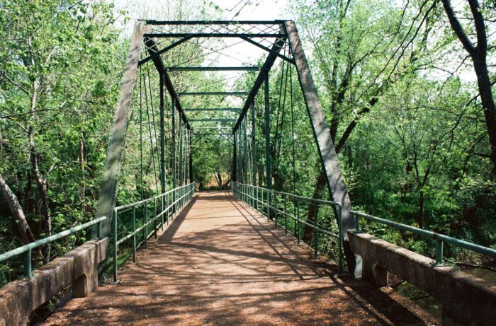
The park includes remains of previous inhabitants, including foundations and roadbeds dating to the 18th century. One road is a prehistoric roadbed. An early Pratt Truss steel bridge is preserved in the park and is open to foot traffic.
Canoeing and fishing is permitted in the Red River and Sulphur Fork Creek. The park also has short trails and a small picnic area.
Fees, permits and reservations may apply.
Park Info
3300 Old Clarksville Hwy
Adams, TN 37010
Find more apps: